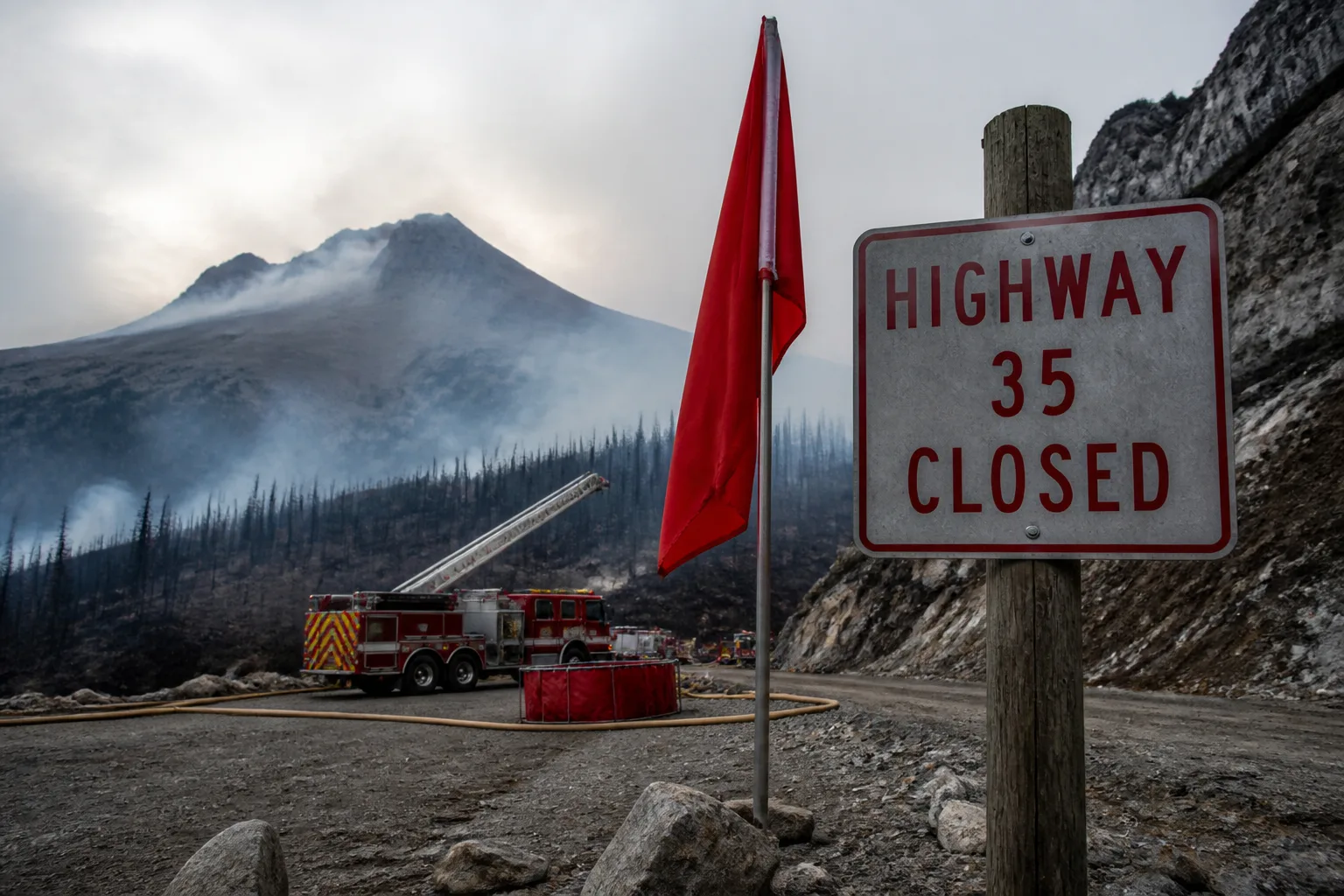
Grasshopper Fire Near Mount Hood Rises to 54,200 Acres, 23% Contained; Highway 35 Closed Amid Red Flag Warning
On July 23, a lightning strike ignited the Grasshopper Fire just outside Mount Hood’s snow‑capped peaks, and the blaze has since leapt across more than 54,200 acres of the Mount Hood National Forest. The Oregon Department of Forestry (ODF) reports the fire is 23 % contained, but the front is still pushing under a Red Flag Warning that warns of hot, dry, and windy conditions.
Fire crews have set up containment lines along the southwestern edge of the blaze, and those barriers are holding steady. In the east, firefighters have wrapped the fire in control, confident it won’t spill further in that direction. The northwest corner is retreating toward Highway 35, but the burn remains in understory vegetation, not being driven by the wind. To protect the road, crews have conducted strategic burns and bulldozer operations, carving firebreaks that keep the highway corridor safe.
The threat isn’t just the open land. In the Teacup Lake area, crews are carving defensible space around homes, and some neighborhoods have already received Level 3 “GO NOW” evacuation orders. The Sherman County Fairgrounds in Moro has opened a shelter for large animals displaced by the fire. Meanwhile, the Mount Hood National Forest has shut off a section of its trail network to keep hikers out of harm’s way.
A notable twist: the Oregon Air National Guard has deployed 44 troops to assist, marking the first time Guard personnel have led a ground firefighting effort in the state. Their role includes aerial support and the use of specialized equipment to help crews build firebreaks and conduct controlled burns.
The Grasshopper Fire is just one flare in Oregon’s blistering wildfire season. To date, more than 1.3 million acres have burned across the state, with July and August proving especially volatile. Lightning‑sparked fires, high temperatures, low humidity, and strong winds have all conspired to fuel rapid spread and slow containment.
Highway 35, which snakes from Government Camp to Hood River, has been partially closed between Bennet Pass Snow Park and Baseline Road in the park’s southern section. The Oregon Department of Transportation urges motorists to take alternate routes, noting that smoke often reduces visibility. Travelers can check the ODOT TripCheck portal for the latest updates.
Fire crews remain on the front lines, constantly monitoring the blaze’s behavior and adjusting tactics as the weather shifts. The primary goal is to limit further spread and safeguard critical infrastructure and communities. Both the ODF and the National Interagency Fire Center will post new updates as the situation evolves.
At this moment, the Grasshopper Fire still poses a serious threat to the Mount Hood area, with over 54,000 acres on fire and only a quarter of the perimeter under control. Residents and visitors are urged to stay tuned to official channels and heed any evacuation orders that may come.